REVIEW · SAN FRANCISCO
Highway 1 Pacific Coast Highway Self-Guided Driving Tour Bundle
Book on Viator →Operated by Drive with Action · Bookable on Viator
A long drive gets way more interesting with audio cues. This Highway 1 Pacific Coast Highway self-guided bundle uses offline GPS and hands-free location-based stories so the scenery has context as you roll south. I love that it’s built for your pace—pause for photos, snack stops, or longer beach breaks—and I also like the one-year validity, so you can squeeze in a return trip later. The one catch: the navigation isn’t super “turn-by-turn,” so you’ll want to keep your eyes on the road and the route to avoid drifting off the path.
The biggest potential drawback is audio sync and routing confidence. If you start late, take lots of detours, or don’t begin exactly where the tour expects, the guidance can feel vague and the audio may not line up with what you’re seeing.
In This Review
- Key highlights at a glance
- A One-Year Highway 1 Audio Road Trip, From San Francisco to Santa Monica
- Price and what you actually get for $29.99 per group
- How the Action’s Tour Guide app works offline (and how not to get stuck)
- Pacifica to Half Moon Bay: bay history, whales, and first big coastline stops
- Devil’s Slide to Santa Cruz: WWII bunkers, seashore hikes, and quirky detours
- Monterey to Carmel and Big Sur: sardines, aquariums, and the first iconic stretches
- Bixby to Pfeiffer: Big Sur’s bridges, purple sand, seals, and the long road of wow
- San Luis Obispo to Santa Barbara: monarchs, dunes, wine murals, and SLO Cal pacing
- Ventura to Santa Monica: surf towns, cliffside stops, and the finish at the pier
- Should you book this Highway 1 self-drive audio tour?
- FAQ
- How much does the Highway 1 audio tour cost?
- How long is the drive with this tour?
- Do I need internet service to use it?
- Where do I start and where does it end?
- Is there a meeting point or guide?
- What do I get included?
- Are attraction tickets included for stops like beaches or state parks?
- What are the operating hours?
Key highlights at a glance
- Buy once, use for a year: the tour stays valid for 12 months, which is great if you’re splitting Highway 1 into multiple weekends.
- Offline-friendly narration: download with strong wifi/cellular, then rely on offline GPS for the route and audio playback.
- Hands-free audio that triggers by location: stories are meant to play automatically as you move along the drive.
- Great value per car: $29.99 covers a group up to 4, so it can beat the cost of guided options for families or carmates.
- Packed with quick hits: you’ll get short stops at landmarks, bridges, lighthouses, beaches, and park passes-by—without needing to pre-book tickets.
A One-Year Highway 1 Audio Road Trip, From San Francisco to Santa Monica
Highway 1 is the kind of road that makes you want to slow down. This self-guided audio tour turns that instinct into a plan. You drive the Pacific Coast Highway from San Francisco down toward Santa Monica, and the narration fills in what you’re passing—history, place names, and why certain spots matter.
What makes this bundle feel practical is the design: once you start it, the audio is meant to run on its own based on where you are. You’re not stuck watching your phone for every instruction. And because it’s valid for a full year, you can use it once for a big southbound sweep—or break it into smaller chunks and come back without rebuying.
The drive time you’ll feel depends on your style. The bundle notes an approx. 10 to 11 hours, but also mentions that the essentials can be covered in 5–7 hours. If you want more beaches, overlooks, and short hikes, plan toward the longer end.
You can also read our reviews of more guided tours in San Francisco

Price and what you actually get for $29.99 per group
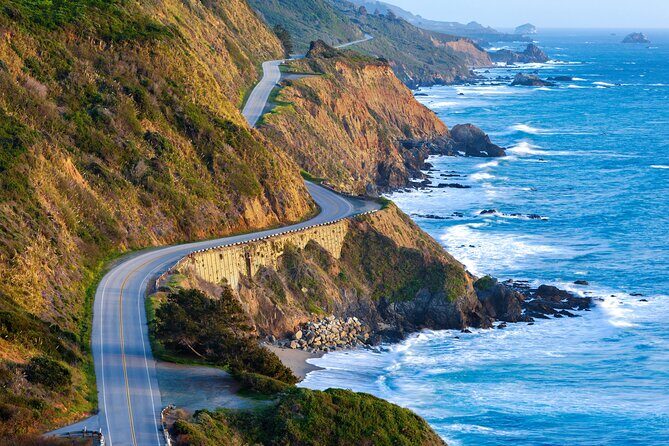
This is priced at $29.99 per group (up to 4), not per person. That’s a real advantage on a road trip where you might have two adults and two kids, or a couple traveling with a friend. In other words, the cost scales with your car—not with your headcount.
You’re also not paying for entrance tickets. The tour itself includes the stories, route guidance, and offline audio. Most stops are listed as free to access, while a few points note that admission tickets aren’t included. So you can spend money where you choose—like an aquarium or a museum—rather than being forced into pre-booked packages.
If you want a “guide in the car,” this won’t replace that. But if you want context and you like the freedom to pause and park when it feels right, the value can be strong for the cost.
How the Action’s Tour Guide app works offline (and how not to get stuck)
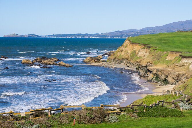
You’ll use Action’s separate audio app. After booking, you get an email/text with setup instructions and a password. The important part: download the tour while you’re on strong wifi/cellular. After that, it’s designed to work offline with GPS.
Once you arrive at the starting point—PG6H+8F San Francisco—you launch the app and start the tour. There’s no person waiting to meet you. You enter the first story’s point, and the audio should begin automatically, then continue as you move to the next location.
Two smart habits will make the experience smoother:
- Start at the designated start point, not a nearby guess.
- Keep to the suggested speed where possible, since the audio is meant to sync with your movement.
If you connect your phone to the car stereo, listening tends to be easier. And if you’ve got multiple versions of the tour in the app, choose the one tied to your planned starting direction.
Pacifica to Half Moon Bay: bay history, whales, and first big coastline stops
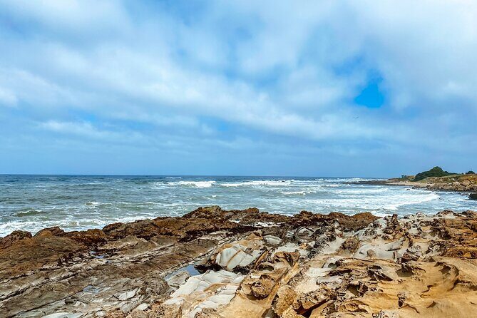
Your first stretch leans into origin stories and early coastal viewpoints. In Pacifica, the narration sets you up with San Francisco Bay history and the Spanish explorer Gaspar de Portolá. You also get the unusual backstory of how Pacifica got its name, which is a fun warm-up while you’re still building that “Highway 1 brain” of what to look for.
Next is Pedro Point, a rocky ocean point with a footpath-only access model at low tide. This is one of those stops where your timing matters. If the footpath isn’t accessible, you won’t be able to “just pop over,” so treat it like a short hike-to-view moment.
Devil’s Slide Trail is brief but memorable: a World War II bunker built to watch for a possible Japanese invasion. Today, it’s a popular local hangout—graffiti artists and the local crowd have turned it into something different from its wartime purpose.
Then you hit Gray Whale Cove State Beach. If you’re driving in December and January, the narration points out the gray whale migration south past this shore, often close enough to spot with the naked eye. If you visit outside those months, you’ll still get a beach stop, but you might have to enjoy it without the guaranteed whale story.
In Montara, the vibe shifts to a smaller, rustic town with deep ties to an old lighthouse and older buildings still standing. It’s the kind of stop that makes the road feel less like a highway and more like a chain of towns with personalities.
A short distance later, you’ll encounter a beach stop noted for some of the biggest swells in the area—peak-season waves reaching up to 60 feet. That’s great for watchers and photo lovers. If you’re not surfing, the main payoff is standing back and watching the power.
Half Moon Bay is next, described as sleepy and seaside. The narration also adds a darker angle: in the past, the area earned a reputation linked to mob activity and corruption. Then you’ll get Bean Hollow State Beach, named for an odd-shaped coastline contour people compare to a bean. It’s humble, pleasant, and made for quick resets.
Finally, Pigeon Point Lighthouse makes a strong photo stop. At 115 feet tall, it’s listed as the tallest lighthouse on the West Coast and one of the oldest. It’s not the kind of stop you need to over-plan. Pull in, take the shot, and keep moving.
Devil’s Slide to Santa Cruz: WWII bunkers, seashore hikes, and quirky detours
After Pigeon Point, the tour starts layering in nature and “drive-by awe.” You’ll pass redwood groves that are described as old and huge—exactly the kind of thing that’s hard to appreciate from a quick look unless the narration frames why they feel so dramatic.
You’ll also pass Big Basin Redwoods State Park, with tall old-growth trees and a canopy that feels cathedral-like by road standards. The tour adds a timing note too: if you’re traveling in the morning, you might even spot wildlife.
Then comes the seal chapter. As you pass a state reserve, the narration encourages you to keep your ears open because elephant seals are among the area’s most famous residents. December through April is best because it’s breeding season. Even if you don’t plan your trip around that window, it’s a good nudge to slow down when you see the pull-offs and viewing spots.
In Davenport, you’ll get a small-town feel (just over 400 people) paired with pristine beaches. The Davenport Crack is highlighted as water-carved, with a deep tunnel through a cliff that makes it look like the land split in two.
The tour then threads in more coastline variety: a cove described as having an ominous shark-fin-like rock formation (even though the narration says you don’t need to worry about sharks), plus pocket beaches that are small and secluded. The trade-off is access: expect scrabbling to reach them, which also helps keep them less crowded.
Santa Cruz is a key stop, and it’s presented as picture-perfect with architecture, eating, and quirky shops. If you want the “main energy” of town, the tour points you toward the Santa Cruz Wharf—with lots of seafood and an amusement park that includes a fully functional wooden roller coaster.
Then you get the fun oddball: The Mystery Spot, opened in 1939 by George Prather. It’s the gravity-defying experience—paired with a short but steep uphill walk and demonstrations inside a wooden building.
The narration also sets you up with beach time options, including a large beach with ample parking and pet-friendly access, plus Sunset State Beach for late-afternoon sunsets. If you’re going for the sunset, don’t treat it as an on-the-fly decision. Plan ahead so you’re not arriving at peak crowds with no parking options.
A wildlife and wetlands stop follows with Elkhorn Slough Reserve, where salt water meets fresh water and the reserve is home to over 700 species of terrestrial and marine animals. Nearby, the tour also includes a drive-by chapter about sardines: how plentiful populations once were, and what changed. It’s a good reminder that “scenery time” also has ecology and human impact woven in.
You can also read our reviews of more tours and experiences in San Francisco


Monterey to Carmel and Big Sur: sardines, aquariums, and the first iconic stretches
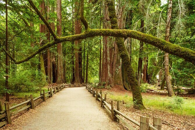
Monterey brings you back to maritime and industrial roots. The narration notes Monterey’s connection to the sardine-packing industry and points to Cannery Row, now known for shops, seafood restaurants, and bars housed in converted factory buildings. If you like learning why a place is named the way it is, this is the kind of stop that pays off.
From there, you’ll be directed toward the Monterey Bay Aquarium, with thousands of marine animals and plants shown through underwater and interactive exhibits. This is the kind of attraction you’d likely want to book separately, because the tour itself doesn’t include entry tickets.
Then the tour commits to “this is why Highway 1 gets famous.” Big Sur arrives with dramatic bluffs above crashing waves and rugged hiking trails through lush greenery. Even if you don’t hike, the narration helps you look at what matters: steep drop-offs, rock formations, and why access is often limited.
A scenic detour option is mentioned: the 17-Mile Drive through Pebble Beach and Pacific Grove, with ocean views on one side and notable estates on the other. This is more of a planned add-on. If you’re trying to keep the trip moving, it can be an easy stop-or-skip depending on your time.
In Carmel-by-the-Sea, you’ll get a charming coastal village with fairytale cottages and lots of art galleries. The tour also includes a stop at a white sand beach beside a cypress grove, described as a place locals surf, walk dogs, or watch sunset.
Near Carmel, you’ll pass a reserve with an emphasis on both marine and terrestrial animals, and it’s framed as a spot for scuba diving if that’s your interest. Again, this is a “drive-by narration” unless you choose to add on time and gear elsewhere.
Then comes Garrapata State Park. The tour calls out that some trails lead to the coast for big views, while other routes cut through valleys and even redwood groves. The drawback is also obvious: trails can be time-consuming, and the tour is designed around short stop windows. Pick what you can realistically do without turning the day into a sprint.
Bixby to Pfeiffer: Big Sur’s bridges, purple sand, seals, and the long road of wow
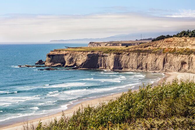
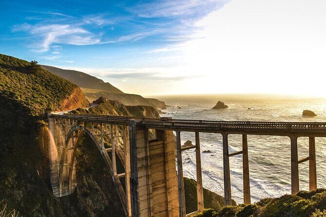
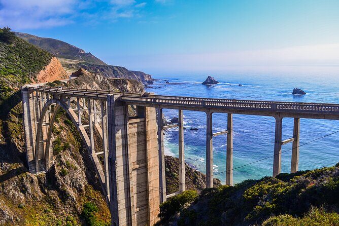
This section is where the audio tour starts stacking “instant photo” moments. Bixby Creek Bridge gets the spotlight early. The narration describes it as one of the most photographed bridges in California, with a concrete arch and a backdrop of lush green bluffs on one side and the ocean on the other. If you only stop for one bridge photo in Big Sur, this is the one they point you toward.
Then there’s Point Sur. The narration explains the mountainous island ship-navigation challenge, now tied to Point Sur Lighthouse placed on the National Register of Historic Places. This is the kind of story that turns a distant sight into something you understand.
The tour also describes a stretch where former owners forbade development for most of the coastline. That’s part of why the wilderness still feels untouched.
You’ll encounter more Big Sur engineering stops, including another bridge described as brand new, built after a predecessor cracked following a major landslide in 2017. These details matter because Highway 1 isn’t just scenic—it’s constantly adapting to geology.
Next up is Pfeiffer Beach, with manganese garnet giving the sand a purple tone. The narration notes it takes a detour down a narrow road. That’s a cue to factor in time and slower driving.
After that, there’s a simple “camera ready” viewpoint stop and then Seal Beach Overlook, where California’s favorite marine mammals are common on the rocks. You’ll have a good chance of seeing more than one seal if conditions cooperate.
Partington Cove follows as a sheltered, secluded cove with a Prohibition-era moonshiner dropoff rumor. Then a dramatic waterfall story appears: a waterfall that once cascaded into the Pacific until mudslides changed the landscape. Even if you don’t see it at full power in the moment, the narration helps you understand what you’re looking at now.
You’ll move to Big Creek Bridge (589 feet long) and another set of turnouts at each end for pulling over. It’s built for exactly what you want to do—pause, admire, shoot a quick photo, and get back on the road.
Then comes Limekiln State Park, named for 19th-century lime production with four historic lime kilns still remaining. If you like industrial history that’s grounded in place, this is a neat change from only beaches and bridges.
Pitkins Curve Bridge is one of those weird engineering stories that becomes fun to read as you see it. The narration explains a protective shed and a bridge designed to safeguard the highway from rockslides, plus the design story behind it.
After that, you’ll pass a secluded cove once connected to a major prospecting rush for jade—plus an old-growth redwood grove where the giants can reach up to 350 feet tall. Then the tour heads to Ragged Point, described as one of the most picturesque stretches in Big Sur with minimal development and bluffs rising up to 400 feet.
There’s also a mention of a rustic inn at Ragged Point, plus another lighthouse described as having a chopped-off top section (explained as part of the story in the narration as you pass). Finally, the tour returns to the animal theme with Elephant Seal Vista Point, highlighting an accessible walkway and a strong chance of seeing seals lounging on rocks.
San Luis Obispo to Santa Barbara: monarchs, dunes, wine murals, and SLO Cal pacing
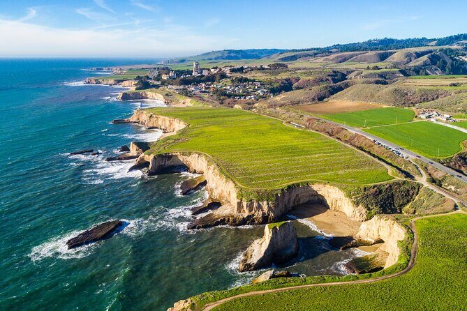
After Big Sur, the route keeps the momentum going with more small towns and coastline variety.
Moonstone Beach Drive gives you a boardwalk-style stretch for legs and quick walking. Nitt Witt Ridge is the “how is this even real” stop: a house built by artist Arthur Beal, made almost entirely from trash.
Then you get Harmony, a tiny community with a recorded population of 18 people. It’s a reminder that Highway 1 isn’t just tourism towns—it cuts through places that barely register on most maps.
Cayucos is next: small, unincorporated, with Wild West-style vibes, saloons, and antique shops. Morro Bay follows, anchored by Morro Rock, a volcanic plug rising 600 feet from the water. The narration notes peregrine falcons nesting there, which gives you something specific to watch for.
San Luis Obispo is called out as a must-see. The tone is California chill—lush greenery, flowers, and an active small city. You’ll also pass Bubblegum Alley, where both walls are covered in bubble gum left by visitors over the years. After that, the narration shifts to land-use history: in the 20th century, the area was home to chromium and mercury mines, and now there are over 8 miles of hiking and mountain biking trails.
Next is Avila Beach, with a dark-to-light storyline: an oil company obliterating the town and then rebuilding it. Dinosaur Caves Park gets mentioned as a picnic stop that doesn’t actually have dinosaurs or caves—still fun for the name alone, if nothing else.
Pismo Beach follows, also described as historically connected to early European missionary landings. The monarch stop is seasonal: between October and February, around 25,000 monarch butterflies shelter in eucalyptus trees. That’s a true “plan your dates” item. If you’re there in season, it can be one of the best moments of the whole day.
In Guadalupe, you’ll get dunes described as the tallest on the entire west coast, reaching up to 500 feet. From the top, the narration promises an unbelievable ocean panorama.
Then the tour points toward Lompoc, famous for flower production and murals around town—40 in total. There’s also the Lompoc Wine Ghetto, framed as a big concentration of world-class wineries and tasting rooms once you get inside. There’s an optional detour called out to Jalama Beach, a quieter alternative if you want crowd-averse coastline time.
The route also includes a string of viewpoints and beaches: Refugio State Beach (white sand, palm trees, shockingly blue water), and another butterfly grove like the monarch area (but eucalyptus trees are struggling, so fewer butterflies are expected). If you’re traveling November to February, it’s still worth considering.
Finally, Santa Barbara arrives as one of the prettiest stops on the drive, described as a former Spanish mission town turned hub for artists, top-tier restaurants, and beach time. The tour includes Thousand Steps Beach with a reality check: there are only 218 steps down.
You’ll also pass Carpinteria State Beach for swimming/camping—and the note that it’s a harbor-seal favorite. Then comes Rincon Beach, a major surfing destination that hosts the Rincon Classic. The tour then includes Faria Beach with emphasis on surfing and limited sand space.
Ventura to Santa Monica: surf towns, cliffside stops, and the finish at the pier
Ventura is the next city stop, described as San Buenaventura, with restaurants and boutiques along the seaside boardwalk. Celeb name-drops aren’t essential, but they’re there in the narration, including Johnny Cash and John Lennon.
Then you head into more classic pull-offs. Point Mugu Rock is framed as an ancient volcanic rock that posed major problems while engineers built Pacific Coast Highway—now it’s a perfect roadside look. Sycamore Cove Beach is highlighted for campers, plus picnic tables and public grills for a proper beach break.
The tour then points to El Matador State Beach, famous for weird rock formations and says sunset is the best time for photos. After that: Point Dume and the connected Zuma Beach, described as favorite beach getaways for LA residents and an iconic filming location tied to Planet of the Apes. Then Malibu closes the loop on the glam beach image, while still keeping it grounded in surfing and laid-back coastline vibes.
When you finally roll into Santa Monica, the tour ends near the Santa Monica Pier—with the advice that there’s plenty more to see in Los Angeles after you finish the audio.
The narration also includes a couple of broader context items you’ll hear along the way, including that State Route 1 runs over 656 miles, plus mentions of the Getty Villa in Pacific Palisades and Hearst Castle in San Simeon. Even if those aren’t central to the drive-by timing, they’re nice “place in the map” anchors.
Should you book this Highway 1 self-drive audio tour?
Book it if you want a lower-stress way to get facts and stories while you drive Highway 1. This is especially good value when you’re splitting the cost in a car up to four people, and the one-year validity makes it friendly for travelers who like to return for beaches or hikes without restarting the hunt for a ticket.
Think twice if you need very strict turn-by-turn guidance. The tour expects you to start exactly on the designated starting point and follow the suggested speed so the audio stays aligned. If you’re the type who loves constant on-screen directions, bring your patience—and keep a map app running in the background.
If you do nothing else, do this before your drive: download the tour on strong wifi/cellular, then start on time at PG6H+8F San Francisco. After that, let the narration do the heavy lifting while you focus on the view.
FAQ
How much does the Highway 1 audio tour cost?
It costs $29.99 per group, up to 4 people.
How long is the drive with this tour?
The experience is listed as 10 to 11 hours approx., and it also notes that the 555-mile essentials can be covered in about 5–7 hours.
Do I need internet service to use it?
The app is designed to work offline after you download. You must download the tour while you have strong wifi/cellular.
Where do I start and where does it end?
You start at PG6H+8F San Francisco. It ends at 108 Santa Monica Pier, Santa Monica, CA 90401.
Is there a meeting point or guide?
No. This is self-guided, and no one will meet you at the start.
What do I get included?
You get engaging audio storytelling, offline maps/GPS, hands-free playback based on location, a comprehensive route with stops, and an app to download and use.
Are attraction tickets included for stops like beaches or state parks?
No. Attraction passes, entry tickets, or reservations are not included. Some stops are listed as free, while others note admission tickets not included.
What are the operating hours?
The listed opening hours are 6:00 AM to 9:00 PM, Monday through Sunday.