REVIEW · SAN FRANCISCO
Point Reyes National Seashore Self Guided Driving Audio Tour
Book on Viator →Operated by Adventures with Action · Bookable on Viator
Point Reyes is better with a talking car. This self-guided audio route strings together hands-free GPS storytelling and offline maps, so you can keep moving even when cell service disappears. Two things I like a lot: the route is designed for an easy drive with short walks, and the narration gives history without turning it into a lecture. One thing to keep in mind: the setup can be a little confusing at first, and GPS audio can act odd if you later retrace the drive in reverse.
The value is strong because it’s priced per car group, not per person, and you get lifetime access with no expiry. If you live nearby or plan multiple trips to the Bay Area, this is one of those purchases you can reuse instead of treating it like a one-and-done outing.
Timing is straightforward but you do need a plan. The full loop covers over 21 miles and typically takes about 2 to 3 hours, ending at the Lighthouse Visitor Center, where parking can get congested on weekends. Also, park passes are not included, so budget for that before you roll in.
In This Review
- Key highlights worth knowing before you go
- Why Point Reyes feels made for a self-guided drive
- Getting set up: offline audio, no staff at the start
- Stop 0: Welcome and the route math you should plan for
- Stop 1: Tomales Point detour for big beach views
- Stop 2 and 3: Drakes Estero and the 2.5-mile trail option
- Stop 4: Cypress Tree Tunnel and the story of KPH Radio
- Stop 5 and 6: Point Reyes Beach and Drakes Beach
- Stop 7: Chimney Rock Trail Head and the quick detour idea
- Stop 8 to 10: Lifeboat station and the elephant seal story
- Stop 10: Sea Lion Overlook steps and how to tell them apart
- Stop 11 and 12: South Beach Overlook to the Lighthouse, plus the Leaning Tree
- Price and value for a 2–3 hour drive: is it worth $16.99 per group?
- Who this self-guided driving audio tour fits best
- Should you book it? My practical call
- FAQ
- How long is the Point Reyes self-guided driving audio tour?
- Can I use the tour offline with no cellular or wifi?
- Where does the tour start and where does it end?
- What is the price and who does it cover?
- Do I need a park pass?
- Do I need to download the tour app and what do I use to start it?
- Is free cancellation available?
Key highlights worth knowing before you go
- 53 GPS-triggered audio stories that play automatically as you pass each spot
- Offline maps + offline audio, so you are not stuck at the edge of bad signal
- A car-friendly route with short walks like the 2.5-mile Drakes Estero trail option
- Cypress-tree set pieces, including the RCA-era KPH Radio station area and the Leaning Tree
- Big wildlife payoff at the elephant seal and sea lion overlooks
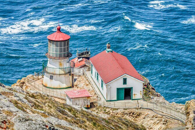
- A lighthouse finish with practical parking guidance, so you know where to stop and park
Why Point Reyes feels made for a self-guided drive
Point Reyes National Seashore is the kind of place where you can spend hours driving slowly, then wander off for photos, then realize you ate up your day. This audio tour is built to fit that rhythm. It is not a strict schedule. You can pause, take breaks, and turn short side walks on or off without feeling like you are late for something.
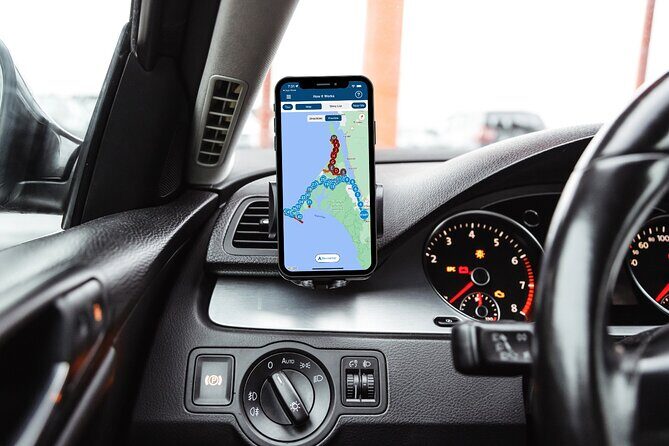
The other big win is that the audio cues are location-triggered. That means you do not need to babysit your phone screen every minute. You drive, you stop, you walk a bit, and the story comes when you reach the spot. For a park that is spread out, this style of touring makes the place feel more connected than just a list of pull-offs.
It also helps that the experience is designed for a 2–3 hour window. You can do this before dinner, or you can pair it with a longer day out in the area. If you want a “great highlights” route rather than a full-day hiking mission, this format hits the sweet spot.
You can also read our reviews of more guided tours in San Francisco


Getting set up: offline audio, no staff at the start
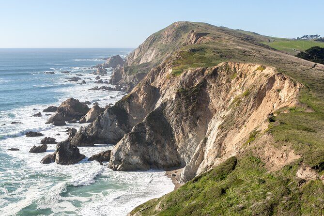
This is a true do-it-yourself tour. No one meets you at the beginning. Instead, you’ll start at 1 Bear Valley Visitor Center Access Road, Point Reyes Station, CA 94956, drive in the direction of the route, and the first story begins as you pass the trigger area.
Before you leave for the park, do the one step that can make or break the day: download the tour while you have strong wifi or cellular. After the download, it works offline, and that matters in Point Reyes where signal can drop. The tour uses the Action Tour Guide app, and after booking you get an email and text with a password. You open the app onsite, enter the password, and launch the correct tour version.
For sound, you can use the car stereo through Bluetooth, USB, or AUX, or just use your phone speaker when you’re out walking. If you want the least hassle on foot, headphones are often the easiest solution. Phone battery also matters here because your device is doing the guiding—so bring a charger if you have one.
Stop 0: Welcome and the route math you should plan for

The tour kicks off with a quick orientation at the start. You are told what you are in for: over 21 miles of driving, more than 53 audio stories, and about 2 to 3 hours overall.
This matters because it sets expectations early. It is a long-ish drive for a “short outing,” but it is also not a grueling day. Most stops have an easy time commitment—usually around 10 minutes for the viewpoint or learning moment, plus extra walking time if you choose a trail detour.
You’ll also notice a couple of optional choices sprinkled in. One of the most time-aware is Tomales Point. If you want that dramatic beach setting, build in the detour. If you’re short on time or just want the drive and overlooks, you can keep it tighter.
Stop 1: Tomales Point detour for big beach views
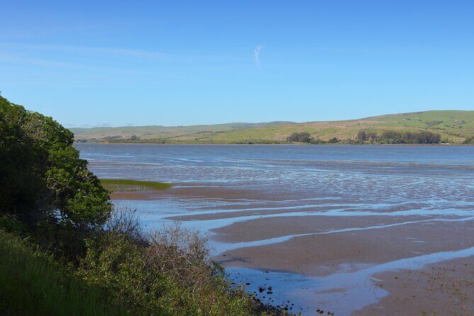
Tomales Point is where the scenery starts to feel like a movie set. As you drive, you get the option to detour to the remote, windswept beaches there. The detour is listed as about 45 minutes round trip, plus walking and photos time.
The practical idea here is simple: this is your first chance to stretch your legs and grab wide coastline views. If you like dramatic ocean edges and want a stop that feels like a real destination rather than a quick pull-off, Tomales Point is the one.
Possible drawback: that 45-minute chunk can squeeze the rest of your day. If you’re traveling with kids, someone with mobility limits, or you’re trying to squeeze in a sunset elsewhere, you may want to treat Tomales Point as optional and decide after you see how your timing is going.
Stop 2 and 3: Drakes Estero and the 2.5-mile trail option
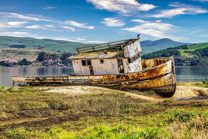
Next up is Drakes Estero. Even if you have never heard the word estero before, the tour explains it in plain terms: it is a marshy inlet. If you’re in the mood for a walk, there’s a 2.5-mile round trip trail option.
The route cue gives you a straightforward fork: turn left at the Drakes Estero Trailhead if you want the hike, or continue driving if you’d rather keep it to overlooks. On the hike route, the experience includes coastal grasslands and a scenic footbridge over the bay.
Why this stop is worth it: wetlands are often where you spot more life than you expect, and the setting is quieter than the open-ocean side. If you only have time for one short walk, this is one of the best choices on the route because it connects you to the shoreline in a hands-on way.
Tradeoff: you need that 2.5-mile round trip time and comfortable shoes. If you’re not feeling a hike, you can still enjoy the idea of the estero from the road without doing the full trail.
You can also read our reviews of more tours and experiences in San Francisco





Stop 4: Cypress Tree Tunnel and the story of KPH Radio
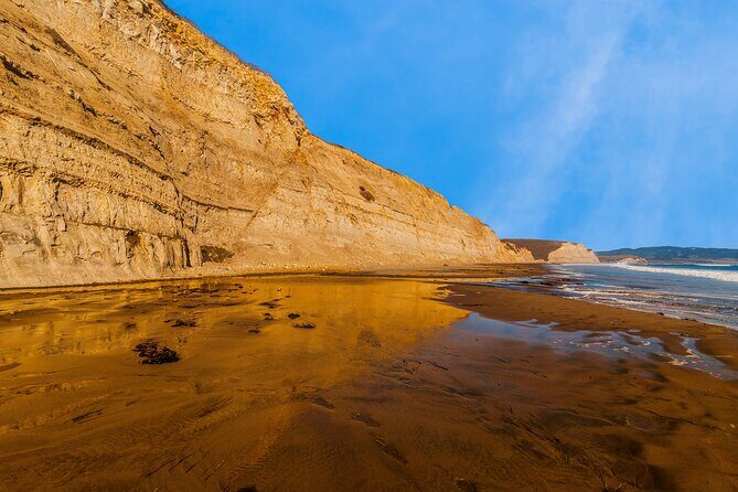
After the wetlands, the tour leans into a different kind of history. You’ll see rows of cypress trees that form a tunnel leading toward the historic KPH Radio station area.
Here’s what makes this stop interesting: it ties a specific communications story to the coast. In the early 1900s, Morse code radio stations were set up along the U.S. shoreline. RCA chose locations to communicate efficiently with ships at sea, and in 1929 they built the station here. They also planted the cypress trees leading toward it so the technology would sit in a thoughtful relationship with the scenery.
This stop is quick, but it is also very photo-friendly. Those tree lines are made for framing, and you’ll likely find yourself taking a few shots just walking up and back.
Stop 5 and 6: Point Reyes Beach and Drakes Beach
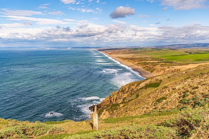
Now you get a classic coast-to-coast contrast: ocean-facing power versus bay-facing shelter.
Point Reyes Beach is described as 11 miles of sand with ocean views. The narration also notes that people often report gray whale sightings from this beach in winter and spring, which is exactly the kind of seasonal detail worth knowing if you’re planning a visit around wildlife.
Then you drive into Drakes Beach, a popular choice because it faces Drakes Bay. The big difference is comfort: winds tend to be calmer and waves less intense than on the open ocean side. The backdrop also includes white sandstone cliffs, which helps the beach feel like more than just a shoreline stretch.
Practical tip: these are stops where the weather matters. Bring layers because the wind can change fast. Also, plan to linger if you’re watching for wildlife or just soaking up the view, since both beaches are designed to be easy places to stop.
Stop 7: Chimney Rock Trail Head and the quick detour idea
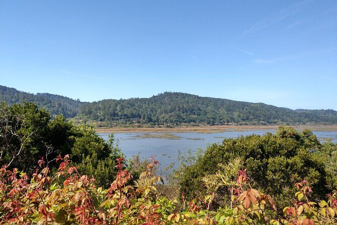
If you want another view without committing to a full hike, this is your moment. The tour directs you to turn left at the fork for a detour that includes the lifesaving station overlook, an overlook for elephant seals, and then a hike to Chimney Rock for ocean views.
This is a classic Point Reyes style choice: you trade some driving time for a better payoff at the end. Even if you do not do the full hike, the stop cue sets you up for those viewpoint moments that make the coastline feel close up.
Consideration: if the weather is rough or you’re short on time, you might skip this detour and keep your energy for the lighthouse finale and the main wildlife overlooks.
Stop 8 to 10: Lifeboat station and the elephant seal story
This part of the drive is where Point Reyes turns from scenery to survival.
At the Historic Point Reyes Lifeboat Station, the narration explains that the first life-saving station operated beginning in 1878. You’ll hear about the roles: the station leader was called the keeper, and the staff were surfmen. The key detail is what they did: they patrolled the beaches, listened for voices through fog, and helped people when wrecks happened. The tour notes that over 37 years, the first station saved people from 14 major shipwrecks.
Right after that comes the Elephant Seal Overlook. This stop has a powerful arc: European settlers used seal blubber for oil, and by 1892 only about 75 seals remained along North America. Protection came in the 1920s from Mexico and the U.S. government, and then the population rose again. By 1981, the first breeding pair returned to Point Reyes, and today the narration points to roughly 200,000 northern elephant seals across the Pacific coast of the U.S. and Mexico.
When to time wildlife: seals are often there no matter what, but the best viewing can depend on the season and light. The tour cue is built for you to stop and look where it matters most.
Stop 10: Sea Lion Overlook steps and how to tell them apart
Right after the elephant seals, you’ll hit the Sea Lion Overlook. It’s a short but real commitment: 54 steps lead down to the coast view, where you can usually find sea lions.
This stop is practical because the tour explains how to tell seals and sea lions apart. Look for ear flaps and folded-in back flippers. Sea lions use those back flippers to shuffle upright on land. The tour also gives quick size and timing: males around 8 feet, females around 6 feet, and breeding season between May and August.
Then you get the behavior angle. During breeding season, sea lions defend territory, fast, and rely on blubber for months. Outside the breeding season, they roam and feed at sea. The tour also mentions a 12-month gestation period, with births often in June or July.
If you are the type who likes wildlife viewing with context, this is one of the strongest stops on the whole route.
Stop 11 and 12: South Beach Overlook to the Lighthouse, plus the Leaning Tree
As you near the end, the tour guides you to the South Beach Overlook and the lighthouse approach. The big practical note here: this is the only parking lot for the lighthouse. If it’s full, you can park on the street, but it can get congested—especially on weekend days.
Once you park, treat the lighthouse area as your final anchor. This is where the tour logic helps you: you don’t have to bounce between random spots looking for the right place. You park once, then work your way through the final viewpoints.
Before you finish, you’ll also see the Leaning Tree—a cypress that leans over the path but, according to the tour, has not seemed to fall. It’s a small stop, but it gives that nice bookend feeling. You started with cypress tunnels and now you end with a single leaning tree that still feels part of the same coastal story.
Price and value for a 2–3 hour drive: is it worth $16.99 per group?
At $16.99 per group (up to 4), you’re essentially paying for one car’s worth of commentary. That matters because Point Reyes is not cheap once you factor in gas and possible park costs, and it can be hard to find guided tours that run in the same flexible format.
What you’re really buying is convenience plus context:
- The offline experience means you can keep driving without worrying about service.
- The automatic audio cuts down on phone fussing.
- The route is built around a mix of viewpoints and short walks, so you get variety without needing a planning session.
You should consider skipping this if you strongly prefer a human guide for Q&A. This is self-guided, and there’s no staff meeting you at the start. Also, if a lot of your group wants to hike long distances, the route is more geared toward “drive + short nature breaks” than full-day trekking.
Who this self-guided driving audio tour fits best
This tour is a great match if you:
- want a highlights route without booking a live guide
- like history tied to real locations, not just facts on a screen
- prefer learning through listening while moving slowly
- are comfortable using a phone app for offline content
It is less ideal if:
- your group struggles with phone setup, downloading, and app passwords
- you want staff to troubleshoot on-site
- you plan to frequently reverse the route and expect the timing to stay perfect
That last point matters because the audio system uses GPS cues, and if you travel the same stretch in reverse, you might hear repeats at unexpected times.
Should you book it? My practical call
Book this if you want Point Reyes to feel guided but still flexible. The story pacing works well for a 2–3 hour window, the offline setup reduces stress, and the stops line up well with what most people actually come to see: beaches, wildlife, and lighthouse-area viewpoints.
Skip it or rethink if you (or your group) need a very simple, staff-led experience. One of the most common pain points with audio tours is user-friendliness at the start—especially for people who are not comfortable with downloading and app passwords. If that might be you, do a test run with the app before your trip and give yourself extra time at the start point.
If you are the type who likes driving scenic routes with meaningful stops, this is a strong use of your day.
FAQ
How long is the Point Reyes self-guided driving audio tour?
It takes about 2 to 3 hours to complete, and the route is over 21 miles long.
Can I use the tour offline with no cellular or wifi?
Yes. The tour includes offline maps, and the audio works after you download the tour while you have strong wifi or cellular.
Where does the tour start and where does it end?
It starts at 1 Bear Valley Visitor Center Access Road, Point Reyes Station, CA 94956 and ends at the Lighthouse Visitor Center, 27000 Sir Francis Drake Blvd, Inverness, CA 94937.
What is the price and who does it cover?
The price is $16.99 per group (up to 4), so it’s priced per car group rather than per person.
Do I need a park pass?
Park passes are not included, so you should plan to cover that separately.
Do I need to download the tour app and what do I use to start it?
After booking, you’ll receive setup instructions with a password by email and text. You download Action’s Tour Guide App, enter the password, then start the tour onsite from the app. The audio triggers automatically as you drive past the first point.
Is free cancellation available?
Yes. You can cancel for a full refund if you cancel at least 24 hours before the experience’s start time. If you cancel less than 24 hours before, the amount you paid is not refunded.